

Mã tài liệu: 202667
Số trang: 690
Định dạng: pdf
Dung lượng file:
Chuyên mục: Khoa học công nghệ
Những tài liệu gần giống với tài liệu bạn đang xem
Những tài liệu bạn đã xem
📎 Số trang: 31
👁 Lượt xem: 443
⬇ Lượt tải: 17
📎 Số trang: 0
👁 Lượt xem: 982
⬇ Lượt tải: 29
📎 Số trang: 3
👁 Lượt xem: 290
⬇ Lượt tải: 11
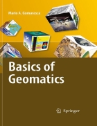
 Basics of Geomatics 1st Edition
Product Description This volume presents a comprehensive and complete treatment. In a systematic way the complex topics and techniques are covered that can be assembled under Geospatial Information namely, Geodesy, Cartography, Photogrammetry,
pdf Đăng bởi
hoanghuongcsb